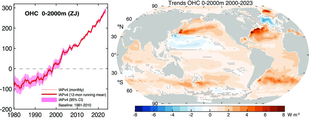
With latest news landing that the current developing El Niño could be the most extreme on record, it is important to revisit fire safety plans. First the El Niño update: With all the July model runs now in, it is very likely that 2026 will see the largest El Niño event since records began in the...
Impacts Insights

Climate induced collapse – a timeline
Earlier this month the Western Cape Government announced that the initial storm damage assesment following the recent extreme weather events had reached a staggering R9 billion, R1 billion of which was in the Garden Route District Municipality
Akkerkloof and the coming El Niño risk window
The last few weeks have revealed that Knysna water security is multifaceted! Obviously it is about having enough rainfall, but another real challenge became visible which is can the town reliably capture, move, store and distribute water during increasingly unstable conditions. Understanding this...
Western Cape Storms: The urgent need for climate adaptation
Fallen trees damaged buildings at Beaumont Primary School in Somerset West. (Photo Credit) Since Tuesday, May 5, 2026, the Western Cape has been battered by a series of devastating storms, leaving a trail of destruction and human suffering. The impacts have been severe and widespread: Loss of Life...
Early Warning: What emerging El Niño signals could mean for Garden Route water security
As we move toward winter 2026, there are growing signs in the Pacific Ocean that El Niño conditions will develop later this year. While it’s still early, these signals matter because large-scale climate patterns like El Niño can influence rainfall variability in the Southern Cape, and therefore...
Knysna water system update: Stable but still under pressure
The Department of Water and Sanitation (DWS) has released its latest weekly dashboard for the Knysna water system, providing a snapshot of consumption, production, and storage levels as of early March. At first glance the situation appears more stable than it did several weeks ago. Akkerkloof Dam...
Sunny-day flooding an early warning signal
We have all seen Waterfront Drive look like this during some high tides. These events often happen when the high tide approaches about 2 metres, especially if a small storm surge is present. It’s easy to dismiss them as an inconvenience caused by an unusually high tide. But in reality, these...
Living Well – Adaptation at 34° South
In the first article, we looked at why regions around 34° South have become less predictable. In the second, we explored why planning systems built for stability now struggle. This final piece is about something more personal. If an unstable climate is becoming normal, how do people live well...
Why the Garden Route cannot rely on rain during the first half of 2026
A new Seasonal Climate Watch released by the South African Weather Service (SAWS) offers an important and sobering piece of context for Garden Route’s current water stress. The short version: there is no clear signal of relief in the months ahead. What the climate outlook is saying According to...

34° South: A New Climate Fault Line
In recent years, when you talk to people living around 34° South they will tell you that something hasn’t been quite right with the climate. Rain still falls, sometimes heavily, yet rivers fail to hold their flows. Dams rise briefly, then slide back. Water stress feels like it is just constantly...